21 February 2025
![]() 6 mins Read
6 mins Read

From Perth to Uluru, the desert blooms with unexpected greenery and wildflowers. Roadhouses and galleries offer Indigenous art to feed the soul. And surprises – think space junk – abound. Landscapes change, each one like something from a painting. Wildlife spotting is assured, from emus bending their knees to drink at a waterhole to bounding kangaroos and wallabies, shuffling echidnas, stealthy snakes and wild camels.
Along this road trip, the road opens up to new experiences and encounters. And at day’s end, outback sunsets light up the sky as you sleep in comfort at Ayers Rock Resort.

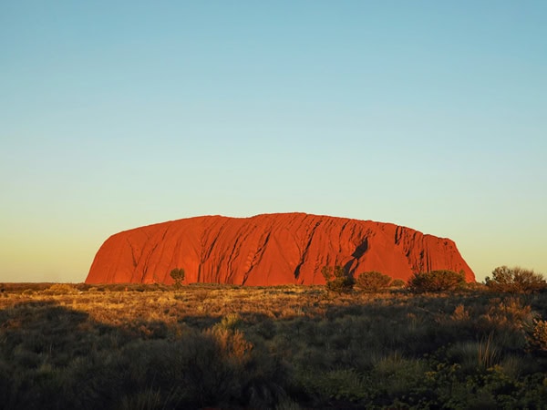
Jump in the car for an epic journey to Uluru. (Image: Tourism Australia)
The 600-kilometre road stretching east from Perth to the former gold mining town of Kalgoorlie is the Great Eastern Highway. Kalgoorlie’s impressive streetscape, with extravagant 1890s architecture and streets wide enough to turn a camel train around in, is a legacy of the great wealth of the gold rush era. With wide verandahs adorned with wrought iron lace, towers and turrets, the town’s heritage pubs are a sight to see.
Don’t miss the chance for a look at Australia’s second-largest open-cut gold mine, the Super Pit. The lookout on the Goldfields Highway, just out of town, provides a vantage point that makes the huge trucks working in the pit look like matchbox toys. The pit itself stretches for 3.9 kilometres in one direction and 1.6 kilometres in another, reaching a depth of 500 metres.
It’s also worth heading to the Mining Hall of Fame, which has five interactive galleries. Do an underground tour, pan for gold, watch a gold pour and wander through a miner’s village.
From Kalgoorlie, it’s 360 kilometres to Laverton, marking one end of the Outback Way. This 2750-kilometre route is dubbed ‘Australia’s longest shortcut’ (the other end is at Winton, in western Queensland).
A fascinating stop along the way is the salt pan of Lake Ballard, near Menzies, with its striking collection of sculptures by British artist Antony Gormley, the world’s largest outdoor sculpture gallery covering seven square kilometres.

Drive around the impressive landscape of Kalgoorlie. (Image: Tourism Western Australia)
Laverton’s main attraction is the Explorers Hall of Fame (in the Great Beyond Visitor Centre). A history walk that takes in the original police station and gaol, along with the Laverton Outback Gallery, selling Indigenous art on behalf of the local Wongi people and the Western Desert.
It’s a 300-kilometre drive on the Great Central Road from Laverton to the Tjukayirla Roadhouse, the perfect spot to refuel and recharge. The roadhouse has artwork from the Blackstone community for sale and there are nearby cave paintings to see.

Take in the history at Laverton’s Historic Police Complex. (Image: Tourism WA)
A highlight of a visit to Warburton – about 246 kilometres – from Tjukayirla, is the Tjulyuru Cultural and Civic Centre. This modern, spacious building is home to the Tjulyuru Regional Arts Gallery, showcasing over 900 works of the Warburton Art Collection (the largest community-owned collection of Indigenous art in the world).
Take a stroll along Elder Creek for wildlife and bird watching. Note: Warburton is a dry community; no alcohol is to be brought into the community or consumed.

See over 900 works from the largest community-owned collection of Indigenous art in the world. (Image: Facebook/Shire Of Ngaanyatjarraku)
At Warakurna – another dry community about 205km further along the Great Central Road – browse in the roadhouse gallery, featuring work from the nearby Warakura Artists studio. Lucky visitors might meet some of the artists here, too.
The nearby Giles Weather Station, operated by the Australian Bureau of Meteorology, is the only staffed weather station within an area of about 2.5 million square kilometres. Its location in the middle of the continent means it plays an important role as a weather and climate observatory for the whole country. Visitors are welcome to watch the daily release of weather balloons and look through the small museum.
The weather station is named for explorer Ernest Giles, the first European to travel through the area in 1874. Modern-day explorer, surveyor and roadbuilder Len Beadell selected the site for a meteorological station in December 1955. Beadell’s grader, estimated to have travelled over 30,000 km in the course of making Outback roads, is on display, along with the remains of the Blue Streak Rocket, launched from Woomera in 1964 and discovered 50km east of Giles in 1980.

See the Giles Weather Station. (Image: Arthur Chapman)
Drive the 75-kilometre stretch between Warakurna and Kaltukatjara / Docker River. After about 25 kilometres, spot a plaque embedded in the trunk of a tall ghost gum alongside the road, a tribute to the crews who constructed the central desert roads in the 1950 and 60s. Docker River marks the border between Western Australia and the Northern Territory.
Tjarlirli Art and Kaltukatjara Art are community-owned art centres on either side of the border between Western Australia and the Northern Territory.
Leaving Docker River, stop at Lasseter’s Cave. Harold Lasseter reported the discovery of a rich gold deposit in the 1930s, the location of which he later searched for in vain. Lasseter’s ‘lost reef’ was never found but travellers now stop at Lasseter’s Cave, where he was said to have sheltered on an ill-fated expedition (during which his camels bolted and left him stranded).
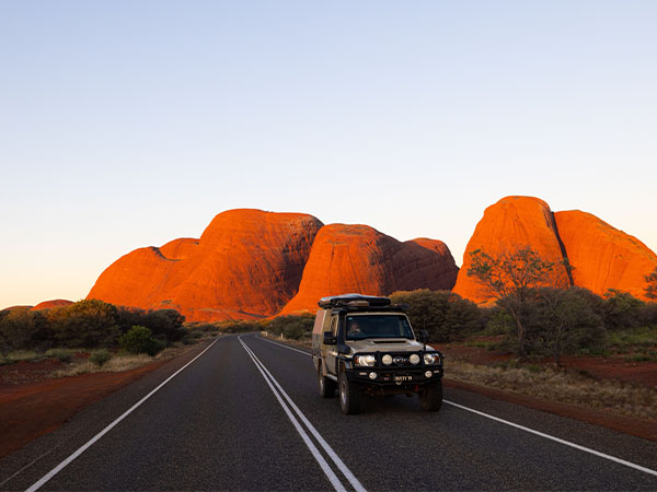
This is the edge of the Great Sandy Desert with red sand hills, mulga scrub, desert grasses and creeks. After rain, wildflowers bloom. Drawing nearer to the town of Yulara – home to Ayers Rock Resort – the first views of Kata Tjuṯa will appear.

The mesmerising peaks of Kata Tjuta. (Image: Tourism NT/Sean Scott)
Arriving at Ayers Rock Resort, book into your choice of accommodation before settling in for a few days of unforgettable experiences. With more than 100 tours and experiences on offer at Uluru and around the resort, there is something for everyone. Enjoy an award-winning three-course bush tucker-inspired buffet before walking around the one-of-a-kind Field of Light art installation, walk or cycle around the 10-kilometre perimeter of majestic Uluru, and so much more.
Discover more with our ultimate guide to Uluru here. Maybe even take your road trip a little further along the Red Centre Way.

Discover Uluru with the freedom of your own car.
LEAVE YOUR COMMENT