17 March 2025
![]() 14 mins Read
14 mins Read
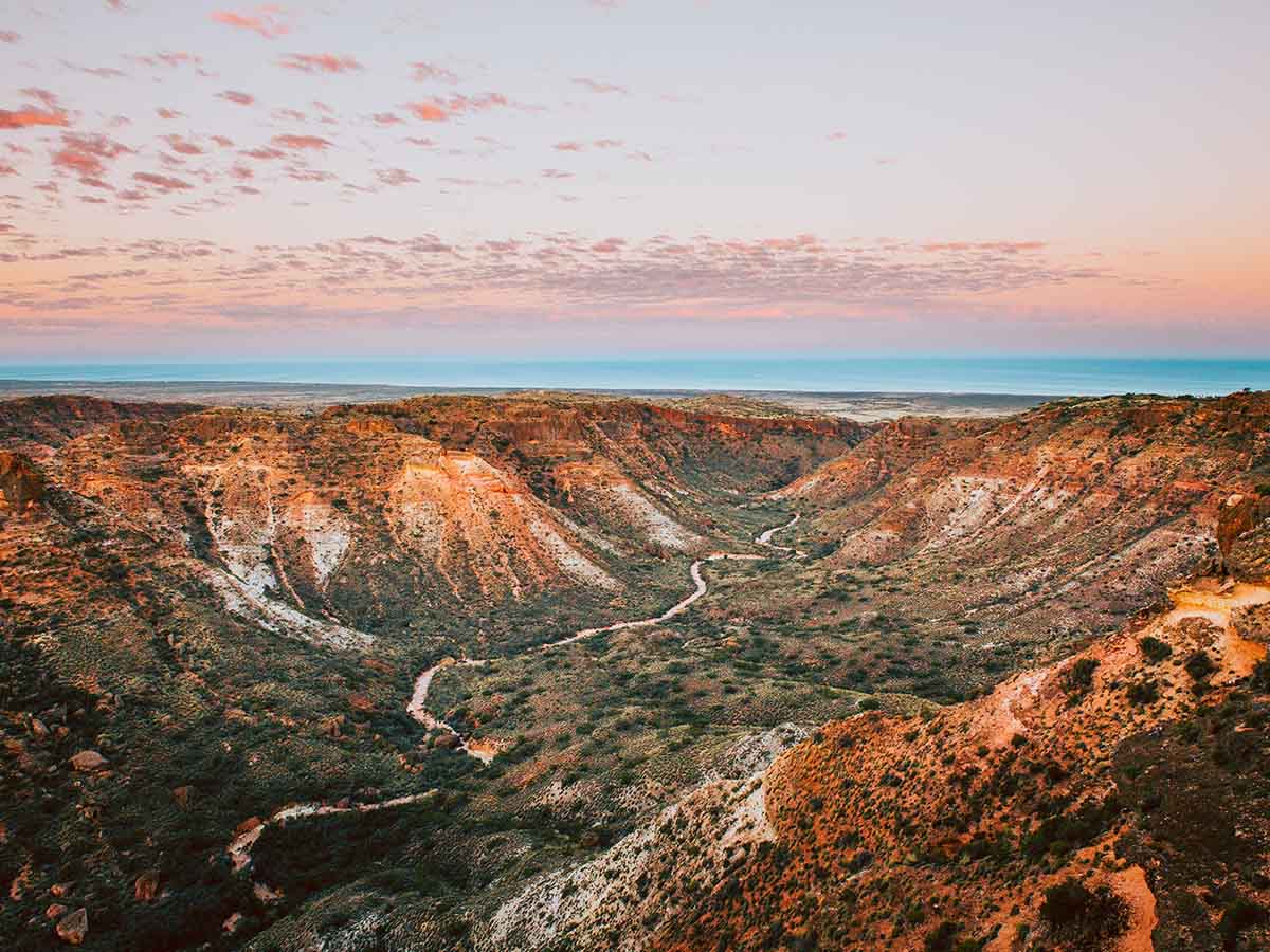
Located on the Coral Coast, Francois Peron National Park sits within the Shark Bay World Heritage Area and is a study in contrasts; rich-red cliffs and desert sands give way to powdersoft white-sand beaches that melt into startlingly blue ocean waters, creating an arresting natural triptych. Covering 52,000 hectares on the Peron Peninsula, known as Wulyibidi to the local Malgana Aboriginal people, the park encompasses arid shrub lands and sun-bleached sand plains, but the watery wonderland at its edge is the real drawcard.
Francois Peron National Park sits within the Shark Bay World Heritage Area and is a study in contrasts. (Image: Tourism Western Australia)
Take the Wanamalu Trail from Cape Peron to Skipjack Point to wonder at the kaleidoscopic colours of Peron Peninsula and Shark Bay. Look down from the dunes at the start of the trail to see cormorants (wanamalu to Malgana people) at the water’s edge, while there’s a good chance of spotting dolphins, dugongs, turtles and manta rays at Skipjack Point Lookout.
The most glorious way to get an insight into just how pristine the waters that lap Francois Peron National Park are is by getting in them: there is amazing snorkelling to be had at Gregories, where at high tide you can easily explore one of the most accessible reef systems within Shark Bay.
Keen anglers and weekend dabblers will relish the chance to throw in a line at various locations such as Big Lagoon and Cattle Well. But do your research and abide by the Department of Primary Industries and Regional Development’s Recreational Fishing Guide; Shark Bay is a listed area so there are designated fishing areas.
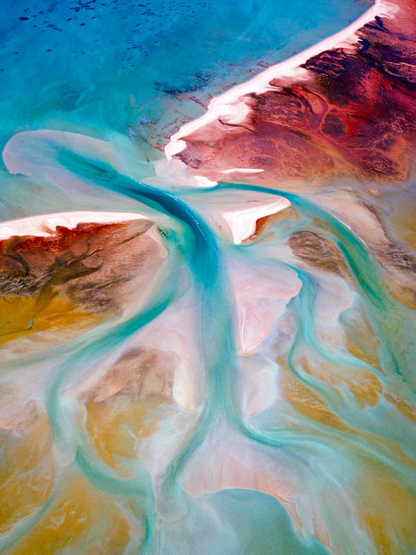
The most glorious way to get an insight into just how pristine the waters that lap Francois Peron National Park. (Image: Tourism Western Australia, @christianfletcher)
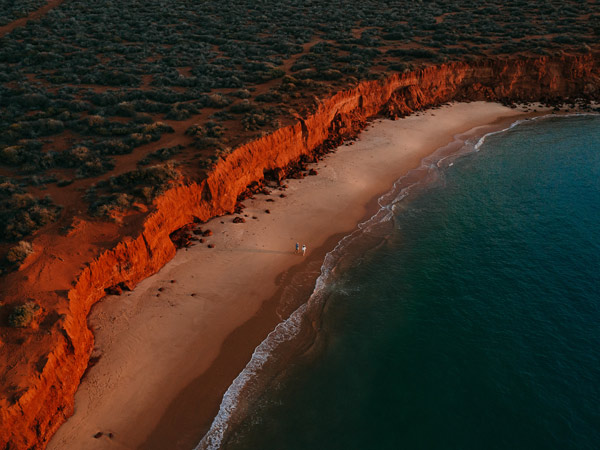
Take up your position on the red cliffs at Bottle Bay to look over its white sands and out to the apparently infinite blue waters where a keen eye (and a set of binoculars) will have you spotting aquatic wonders including whales in season.
The park was once the site of a pastoral sheep station, the remnants of which give an insight into what life was like for the shearers who once worked and lived there. There’s an interpretive centre and a self-guided walk trail, but you should definitely make time to soak in the hot tub, which is fed by the warm artesian waters that once supplied the stock here.
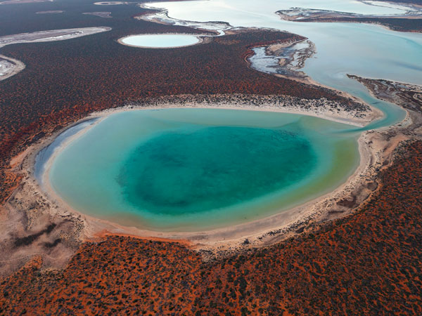
These inland saltwater lagoons are possibly the ultimate evocation of the park’s singular beauty, large bodies of deep-blue/green-hued water edged by rich, ochre punctuated by low, hardy scrub. The calm waters are endlessly alluring for swimming and snorkelling, but you won’t be alone: dolphins, dugongs, manta rays and sharks also enjoy a dip in Big Lagoon’s waters.
There’s an interpretive centre and a self-guided walk trail. (Image: Tourism Western Australia)
The duality of the desert and the ocean in Francois Peron means there is plentiful and diverse fauna to be found here, from roos, echidnas and the quizzical thorny devil lizard on land to sharks, stingrays and a mesmerising array of fish in the water.
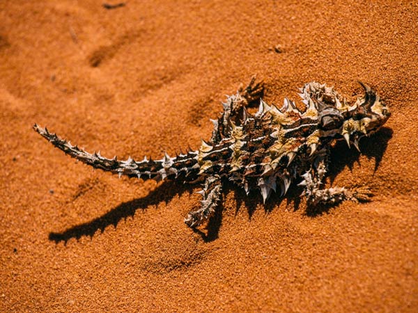
The duality of the desert and the ocean in Francois Peron means there is plentiful and
diverse fauna to be found here. (Image: Tourism Western Australia)
Some 150 kilometres north of Geraldton, this 186,000-hectare park is located in the lower reaches of the Murchison River on Australia’s Coral Coast. The river has carved arresting red-and-white-banded gorges over a staggering 400 million years that, when married with plunging coastal cliffs and ethereal sand plains, create a landscape of great drama and beauty. The traditional Country of the Nanda people, the park is rich in history and stories.
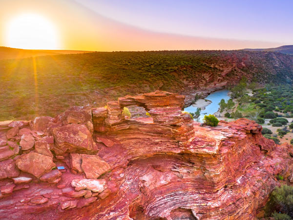
The park is rich in history and stories. (Image: Tourism Western Australia, @aeroture_au)
Challenging yet rewarding, the eight-kilometre Loop Walk skirts the edge of the cliffs above the Murchison River, before descending to the river bank below with its shady beaches and wild swimming. Looping back, the trail climbs out of the gorge back to the starting point at the iconic landmark attraction known as Nature’s Window.
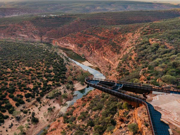
The man-made form of the spectacular Kalbarri Skybridge complements rather than detracts from the natural landscape, with its boomerang shaped twin viewing platforms jutting 25 and 17 metres beyond Murchison Gorge rim, some 100 metres above the riverbed. Stand in awe of the expansive views from the vertiginous platforms and then stop for lunch at the kiosks.
The Birgurda Trail, named for the small kangaroos that can sometimes be seen along its length, is an eight-kilometre (one-way) hike that connects Natural Bridge with Eagle Gorge, named for the eagles that nest there. Or embark on the 2.6-kilometre (return) Z Bend River Trail which boasts steep descents and ladder climbs down into the Murchison River Gorge.
Stand in awe of the expansive views from the vertiginous platforms. (Image: Tourism Western Australia)
This easily accessed rock formation (it’s located 500 metres from The Loop/Inyala Wookie Watju carpark) is considered one of the state’s most iconic natural attractions. Formed from layers of Tumblagooda sandstone, it frames a view of the Murchison River that is literally picture perfect.
The elements have been kind to the landscape of Kalbarri, forming Natural Bridge, a keyhole-like bridge in the coastal rocks, and Island Rock, a lonely ‘sea stack’ now isolated from the shoreline. Both are easily accessible and offer up the chance to spot dolphins and whales from their viewing points.
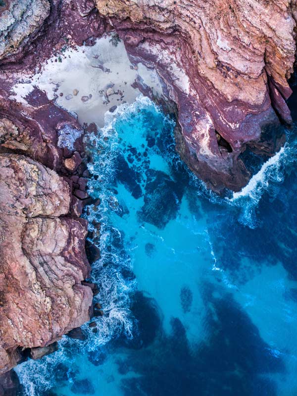
With its white sands butting up against deep red-hued rocks, Red Bluff is aptly named. The warm golden glow of the retreating sun lights up the beach and rocks at the end of the day, making it the perfect time to see it in all its glory from the Red Bluff Lookout. Head down along the beach trail, known as Gaba Gaba Yina, to walk along the beach and enjoy a refreshing dip.
Abseiling is an option in Kalbarri National Park for those with a sense of adventure. (Image: Tourism Western Australia)
Abseiling is an option in Kalbarri National Park for those with a sense of adventure. Kalbarri Abseil’s Adventure Tour offers visitors the chance to take in stunning bird’s-eye views while abseiling 25-metre and 35-metre walls at Z Bend, with a dip in the Murchison River as a reward.
You’ll want to keep your eyes peeled for kangaroos, emus, echidnas, thorny devils and wedge-tailed eagles wheeling above. In the park’s inland gorges, the sweet-faced tammar wallaby is being reintroduced in numbers and, on the coast, it is all about spotting dolphins and whales.
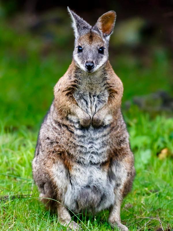
You’ll want to keep your eyes peeled for kangaroos.
A 45-minute drive from Esperance on the state’s southern coastline, Cape Le Grand National Park is replete with too-beautiful-to-be-true coastal scenery, imposing granite outcrops, white-sand beaches complete with inquisitive roos at Lucky Bay, inviting freshwater pools and a profusion of wildflower colour come spring. Established in 1966 and stretching more than 31,000 hectares, the park, which occupies the Traditional Country of the Njunga people, can be accessed as an easy day trip from Esperance. The campgrounds at Le Grand Beach and Lucky Bay also offer the chance to sleep under canvas with the lapping waves as your lullaby.
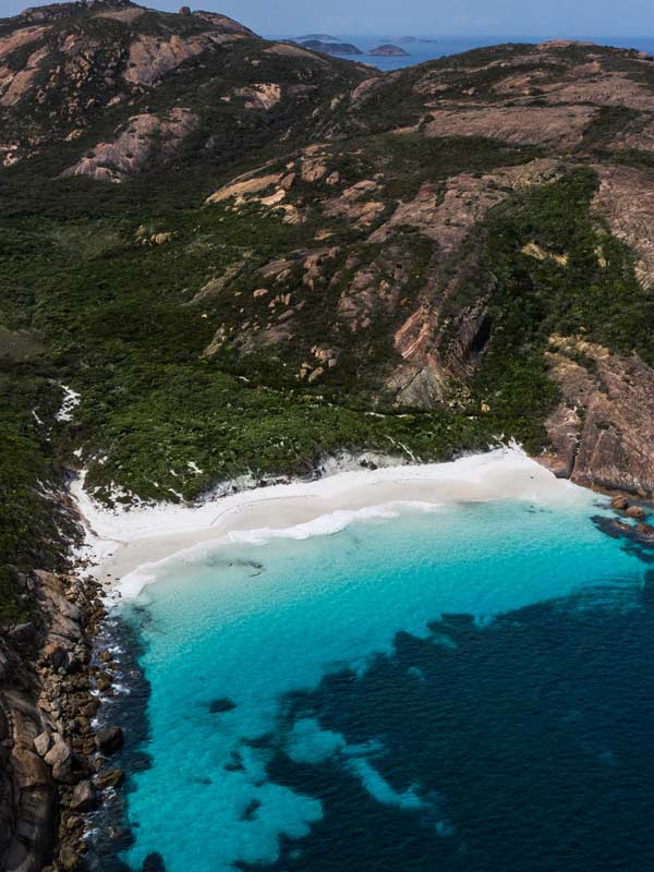
Cape Le Grand National Park is replete with too-beautiful-to-be-true coastal scenery. (Image: Tourism Western Australia)
The Le Grand Coast Track is a 15-kilometre (one-way) walk from Le Grand Beach to Rossiter Bay over rocky headlands, coastal heaths and the beaches of Hellfire Bay, Thistle Cove and Lucky Bay. While experienced walkers can tackle the walk in its entirety, it can also be broken up into sections. However you attack it, the scenery is worth the effort.
This 262-metre granite dome, known as Mandooboornup to the local Njunga people for whom it is an important cultural site, presents panoramic views from its peak of the park and out to the islands of the Recherche Archipelago.
It might sound incongruous, but the allures of Cape Le Grand National Park stretch to the cosmopolitan, with the Aboriginal-owned and operated Lucky Bean coffee van offering up coffee, bushflavoured muffins, damper and jams, toasties and cakes at the edge of the sand. Coffee with a view has never rung truer.
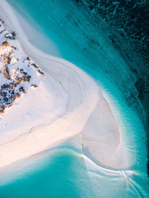
Sleep under canvas with the lapping waves as your lullaby. (Image: Tourism Western Australia)
Sandwiched between greeny-blue waters and high grassy dunes, and bookended by hulking granite rocks, the silky white sands on this secluded beach squeak on cue under foot. Head here for swimming, snorkelling, fishing and surfing.
Inquisitive kangaroos, startling white sands, translucent blue waters. Enough said.
This stunning 200-metre white-sand beach, largely undiscovered by visitors to the park, offers blissful solitude in which to swim, snorkel or just be still listening to the symphony sounds of nature.
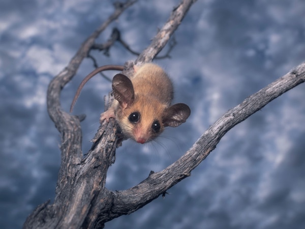
there is diverse wildlife to be found here including pygmy possums.
While the roos at Lucky Bay are the most photographed inhabitants of the park, there is diverse wildlife to be found here including bandicoots, pygmy possums, ringtail possums and quenda (southern brown bandicoot). As for flora, dense thickets of showy banksia proliferate come spring.
Stretching across nearly 630,000 hectares in the Hamersley Range in the Pilbara, Karijini National Park boasts a rugged, unspoilt landscape carved out over some 2.5 billion years and characterised by deep gorges, waterfalls, vertiginous chasms, waterholes and vibrant pindan orange expanses. Sitting just north of the Tropic of Capricorn on the land of the Banyjima, Kurrama and Innawonga peoples (Karijini is the Banyjima name for the Hamersley Range), who have dwelt here for more than 30,000 years, the park has a tropical, semi-desert climate that can see the summer temperatures topping out at 40°C. The best time to visit is in the more temperate months from late autumn to early spring (be advised, it gets chilly during the night in winter).
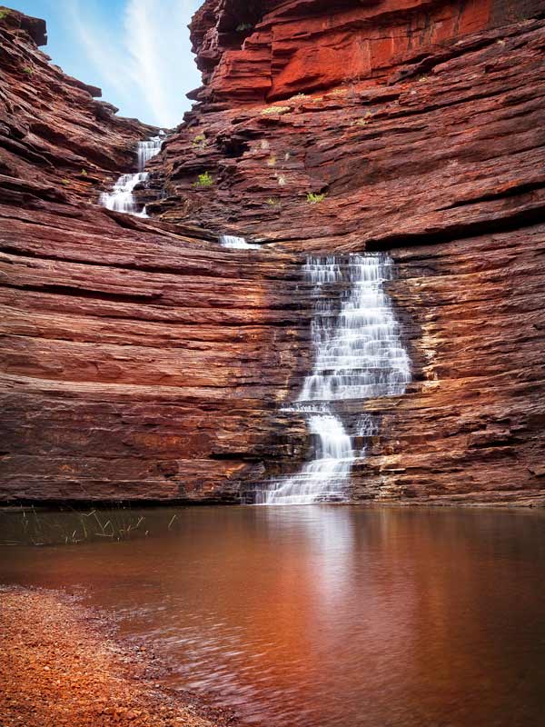
Karijini National Park boasts a rugged, unspoilt landscape carved out over some 2.5 billion years. (Image: Tourism Western Australia)
The park is dotted with pristine waterholes where the heat and dust of the day can be washed away by the cool, tranquil waters. Fern Pool in Dales Gorge, an easy 300-metre walk from Fortescue Falls, is the easiest to access, but a bit of effort brings rewards at Circular Pool, also in Dales Gorge, Spa Pool in Hamersley Gorge and Rock Arch Pool in picturesque Kalamina Gorge.
Camping overnight comes with privileged access to the breathtaking sweep of the night sky glistening with stars. Remtrek Astronomy’s stargazing experience takes place near the Dales Campground and includes expert commentary and the chance to view the inky night ceiling through its three large telescopes.
Pack your walking shoes and set off on the easy Gorge Rim trail, which navigates Dales Gorge from Fortescue Falls to Circular Falls and back again in a two-kilometre return journey with jaw-on-the-floor views all the way. Or, if you are a little more seasoned, try the nine-kilometre (six hours return) Mt Bruce (Punurrunha) summit hike; it can be challenging, but the views are ample compensation.
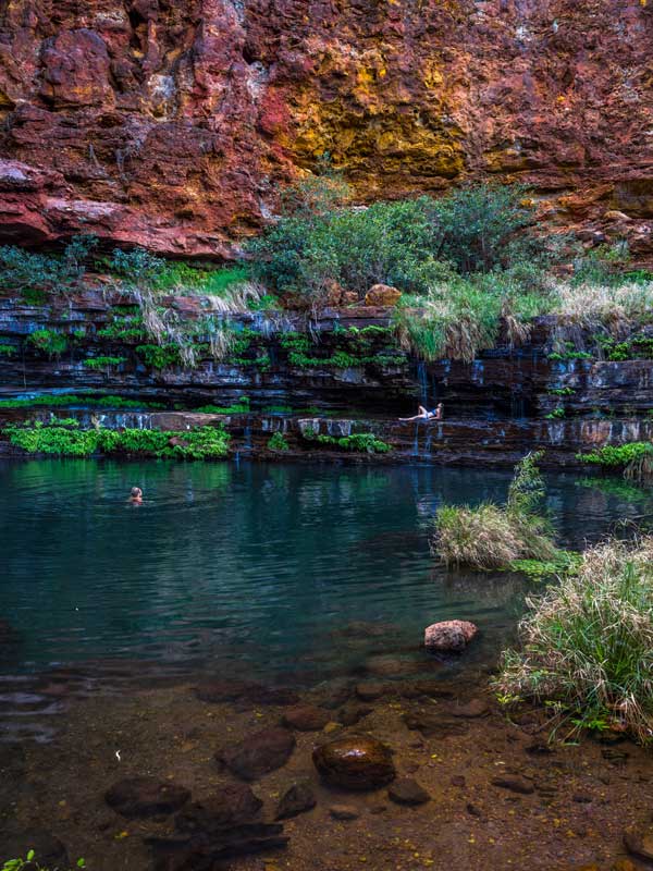
Pack your walking shoes and set off on the easy Gorge Rim trail. (Image: Tourism Western Australia)
One of Karijni’s most transfixing enticements is its wealth of gorges, deep scars gouged into the landscape. The drama of their soaring sides, the cool enticement of still waters and the abundance of flora and fauna that dwell in and around them means it is almost impossible to single out just one or two for attention: Weano Gorge, Dales Gorge, Hancock Gorge, Hamersley Gorge and Joffre Gorge should all be on your list.
These picturesque spring-fed falls cascade down the stepped rocks all year round, making it the only permanent falls in the park. A dip and a happy snap while waist-deep in the waters that pool at its base are absolute must-dos.
Placed as if by providence at the junction of Joffre Gorge, Weano Gorge, Red Gorge and Hancock Gorge, this vantage point offers up one of WA’s most quintessential panoramas down sheer red/orange cliff faces into the plunging gorges and the waters at their bases. Sleep tight There are two locations for overnight camping in the park, including at Dales Campground. Or you can really indulge in the experience with a stay in one of the luxe eco tents at Karijini Eco Retreat, which is proudly Indigenous owned.
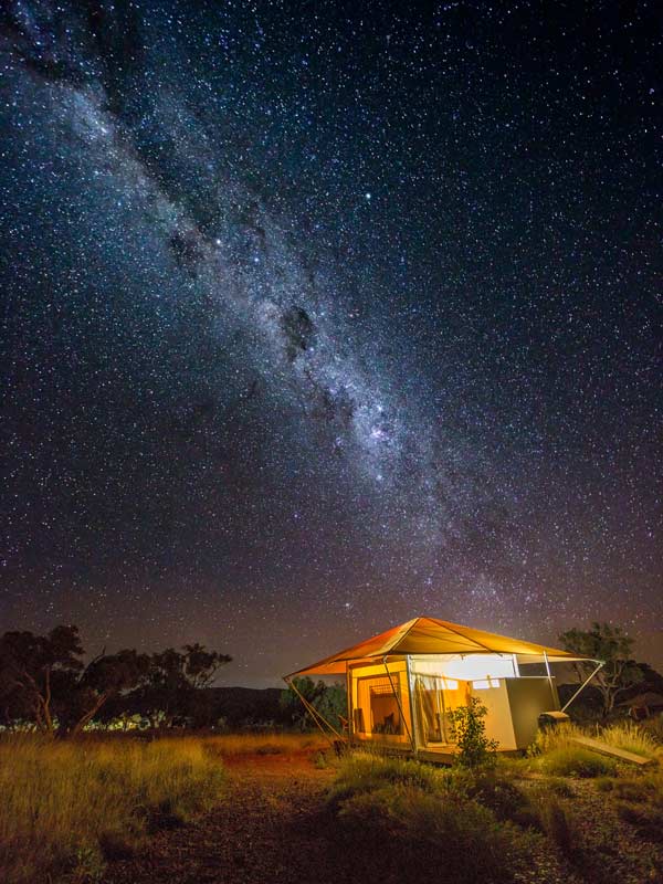
Camping overnight comes with privileged access to the breathtaking sweep of the night sky glistening with stars. (Image: Tourism Western Australia)
The park is home to a veritable menagerie of species, from frogs to fish to birds. Keep your eyes peeled for the Western pebble-mound mouse, which lives among the spinifex and makes its mound from small pebbles, the sweet-faced Rothschild’s rock wallaby and the unique Burton’s snake lizard (also known as the Burton’s legless lizard), one of the many snakes and lizards at home here.
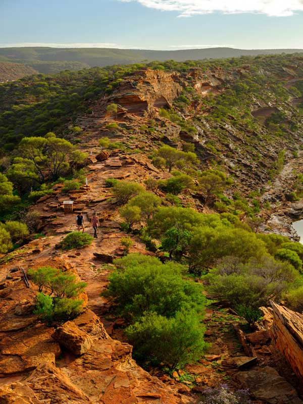
The park is home to a veritable menagerie of species. (Image: Tourism Western Australia)
Located within the Ningaloo Coast World Heritage Area, 40 kilometres south-west of Exmouth, Cape Range National Park sprawls across 50,581 hectares dotted with limestone ranges, canyons, 50 kilometres of immaculate beaches and more than 700 caves. Known as Warnangura in the Baiyungu local language, Cape Range has been culturally significant to the Baiyungu, Thalanyji and Yinikurtura Traditional Owners for thousands of years.
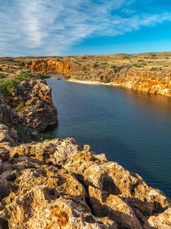
Cape Range has been culturally significant to the Baiyungu, Thalanyji and Yinikurtura Traditional Owners for thousands of years. (Image: Tourism Western Australia)
The three-kilometre (return) Mandu Mandu Gorge walking trail snakes its way along a rocky creek bed deep in the gorge, before a steep path delivers you to the gorge rim with its awesome views out to Ningaloo Reef. The walk is best experienced in the early morning or late afternoon.
The trails into Charles Knife Canyon and Shothole Canyon are easily accessed from Exmouth. Charles Knife Road winds to the top of the range, with views over the Cape Range landscape and Exmouth Gulf. The Shothole Canyon drive is a 12-kilometre-long scenic 4WDonly route along the floor of the gorge, walled with limestone.
Turquoise Bay boasts one of the best beaches in the country, and snorkelling here offers the opportunity to see colourful marine life. Oyster Bay, meanwhile, is located in a sanctuary zone encrusted with oysters in Ningaloo Marine Park (so look but don’t touch).
The sheer cliffs of Yardie Creek Gorge plunge to the abundant waters of Yardie Creek below, where you can canoe, kayak or join a leisurely boat tour. There are two walks you can attempt here: the easier Yardie Nature Walk and more challenging Yardie Gorge Trail.
The abundant mangrove trees here offer the perfect camouflage for its bird hide, where resident and migratory birds can be observed as they come to feed, frolic and rest in the sheltered bay, as the tides ebb and flow.
The UNESCO World Heritage-listed Ningaloo Reef is one of the largest fringing reefs and one of the longest near-shore reef systems in the world, where visitors can swim with majestic whale sharks (which are really fish) and actual whales.
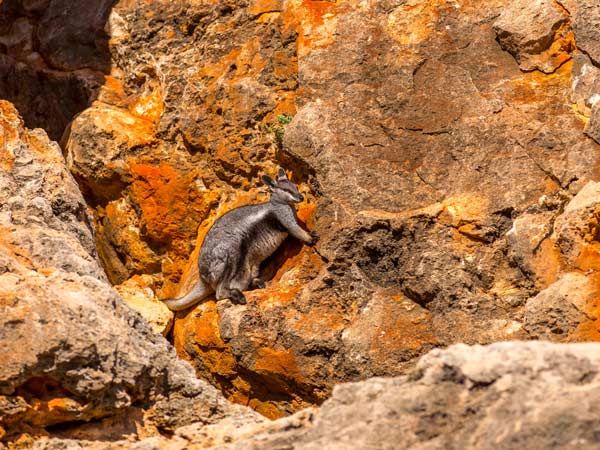
The park’s isolation means endemic plant and animal species flourish.
The park’s isolation means endemic plant and animal species flourish, including the white-centred Sturt’s desert pea in wildflower season. Kangaroos, emus, black-flanked rock wallabies, dingoes and perentie (a large lizard) all thrive here.
There is an abundance of campgrounds within the park that offer visitors the chance to experience a blissful remove from modern life. Book a spot – demand is high from April to October – and indulge in the privileged immersion into nature at its most elemental that overnighting here provides.
LEAVE YOUR COMMENT